[ENG]
I really like hiking in the mountains and every time we visit a new country we try to climb its highest peak. Before leaving for South America, we knew that conquering the highest peaks in Andean countries such as Argentina, Chile, Peru, Bolivia, Ecuador, and Colombia was definitely beyond our reach. The highest Brazilian peak, Pico da Neblina, could theoretically be attacked because it is only 2,994 m above sea level. so if it wasn't very technically difficult, it would be possible to get there somehow, but a glance at the map dashed our dreams. The peak is located in the middle of the Amazon, so reaching it would probably be impossible, and reading Wikipedia, which contains information about flies and mosquitoes carrying dangerous diseases, smugglers camping in this region and the need to obtain the necessary permit to reach the peak made it more likely for us to climbing a six-thousander than Pico da Neblina, which is a pity because the mountain is very beautiful.
After this quick selection, we were left with the two highest peaks in Paraguay and Uruguay. Only their achievement was within the reach of our skills and financial and time resources, and the highest peak in Uruguay - Catedral is only 513 m above sea level. and looks very unattractive. So we were excited about Paraguay and its Cerro Tres Kandu, 842 m above sea level. Not much, I would even say not much - because it is only 100 meters more than Ślęża, and the total number of climbs is almost the same as from the parking lot in Palenica to Morskie Oko. Before leaving, we thought that this peak would be a piece of cake, but a successful exit and descent from such a mountain is not that easy.
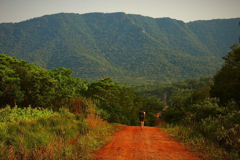
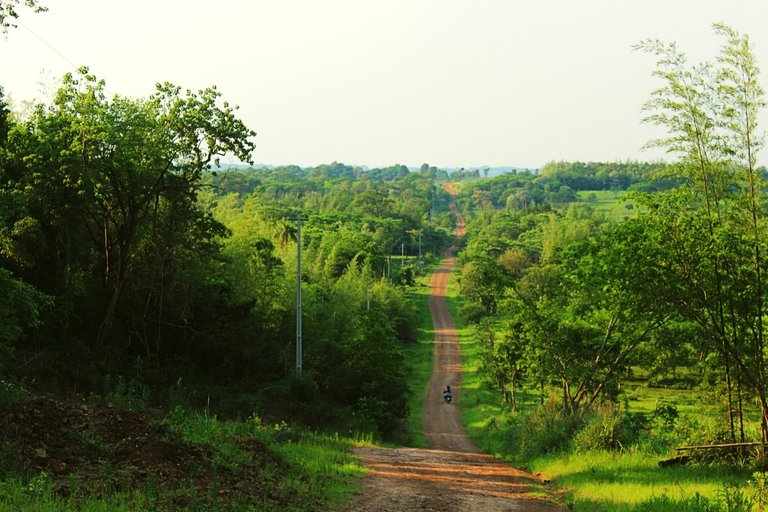
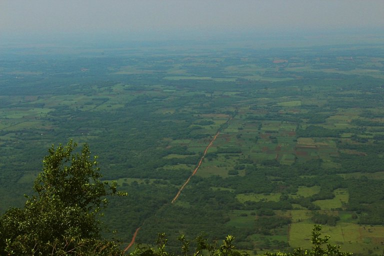
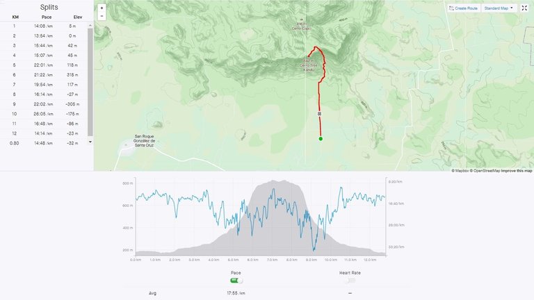
It was October, it was spring in Paraguay, which meant the thermometer showed 42°C. To complete the entire route, which took only 3 hours and 49 minutes, we used 5 liters of water, and if we could have drank more, we would have drank it in one sip. This heat was taking a toll on me. An attempt to cross in the evening, when the heat was less severe, was definitely not an option because the road leading to Cerro Tres Kandu was swarming with all kinds of tropical spiders after dark. Fortunately, during the day the spiders sleep hidden in some holes, so our only problem was the hot sun shining almost straight at an angle of 90 degrees - to suffer in the sun rather than be eaten by spiders, so the next day in full sun (we were near the Tropic of Capricorn and the winter solstice was just a few days away). few weeks) we set off and reached the summit of Cerro Tres Kandu. The peak was very specific, because it rose directly from a lowland stretching many kilometers deep into the continent. Even though we were only 400 meters above the surface of this lowland, we had the impression that we could see objects hundreds of kilometers away. Fortunately, this region of Paraguay was not very urbanized, so this amazing panorama was not marred by any chimneys, masts, towers, skyscrapers, etc. Wherever the eye could see, we could only see farmlands and forests.
[PL]
Bardzo lubię chodzić po górach i za każdym razem gdy odwiedzamy jakiś nowy kraj staramy się zdobyć jego najwyższy szczyt. Przed wyjazdem do Ameryki Południowej wiedzieliśmy, że zdobywanie najwyższych szczytów w krajach Andyjskich takich jak Argentyna, Chile, Peru, Boliwia, Ekwador, i Kolumbia są zdecydowanie poza naszym zasięgiem. Brazylijski najwyższy szczyt Pico da Neblina teoretycznie moglibyśmy zaatakować bo ma wysokość zaledwie 2994m n.p.m. więc jeśli nie byłby bardzo trudny technicznie to da się go jakoś zdobyć, ale rzut okiem na mapę rozwiał nasze marzenia. Szczyt znajduje się w samym środku Amazonii więc dotarcie do niego byłoby prawdopodobnie niemożliwe, a lektura Wikipedii, która informacje o muchach i komarach przenoszących niebezpieczne choroby, przemytnikach koczujących w tym regionie oraz konieczności uzyskania niezbędnego zezwolenia na zdobycie szczytu spowodowały, że bardziej prawdopodobne dla nas byłoby zdobycie jakiegoś sześciotysięcznika niż tego Pico da Neblina, a szkoda bo góra jest bardzo ładna.
Po tej szybkiej selekcji pozostały nam dwa najwyższe szczyty w Paragwaju i Urugwaju. Tylko ich zdobycie było w zasięgu naszych umiejętności oraz zasobów finansowo-czasowych, przy czym najwyższy szczyt Urugwaju - Catedral liczy zaledwie 513 m n.p.m. i wygląda bardzo nieatrakcyjnie. Napaliliśmy się więc na Paragwaj i jego Cerro Tres Kandu liczące 842m n.p.m. Nie wiele, powiedziałbym nawet, że mało - bo to tylko o 100 metrów więcej niż Ślęża, a suma podejść jest prawie taka sama jak z parkingu w Palenicy do Morskiego Oka. Przed wyjściem myśleliśmy, że ten szczyt to będzie bułka z masłem, jednak szczęśliwe wyjście i zejście z takiego dziada nie jest takie proste.
Był październik, w Paragwaju trwała wiosna, a to oznaczało, że termometr pokazywał 42°C. Na przejście całej trasy trwające zaledwie 3 godzin 49 minut, zużyliśmy 5 litrów wody, a gdybyśmy mogli wypić więcej to też by się wypiło jednym łyczkiem. Ten upał dawał nieźle w kość. Próba przejścia wieczorową porą kiedy upał mniej doskwierał zdecydowanie odpadła ponieważ na drodze prowadzącej do Cerro Tres Kandu po zmroku aż roiło się od tropikalnych pająków wszelkiej maści. Na szczęście w dzień pająki śpią schowane w jakiś norach, więc jedynym naszym problemem było upalne słońce świecące niemal prosto pod kątem 90 stopni cierpieć na słońcu niż być zjedzonym prze pająki dlatego następnego dnia w pełnym słońcu (byliśmy w pobliżu zwrotnika koziorożca a do przesilenia zimowego brakowało nam kilku tygodni) ruszyliśmy i zdobyliśmy szczyt Cerro Tres Kandu. Szczyt był bardzo specyficzny, bo wyrastał wprost z sięgającego na wiele statek kilometrów wgłęb kontynentu niziny. Mimo, że byliśmy zaledwie 400 metrów nad powierzchnią tej niziny, to mieliśmy wrażenie, że moglibyśmy zobaczyć obiekty oddalone o setki kilometrów. Całe szczęście ten region Paragwaju nie był zbyt zurbanizowany, więc tą niesamowita panoramę nie szpeciły żadne kominy, maszty, wieże, drapacze chmur itp. Gdzie okiem nie sięgnąć, mogliśmy oglądać tylko pola uprawne oraz lasy.
Congratulations, your post has been added to Pinmapple! 🎉🥳🍍
Did you know you have your own profile map?
And every post has their own map too!
Want to have your post on the map too?
- Go to Pinmapple
- Click the get code button
- Click on the map where your post should be (zoom in if needed)
- Copy and paste the generated code in your post (Hive only)
- Congrats, your post is now on the map!

Congratulations @olusiu! You received the biggest smile and some love from TravelFeed! Keep up the amazing blog. 😍 Your post was also chosen as top pick of the day and is now featured on the TravelFeed front page.
Thanks for using TravelFeed!
@for91days (TravelFeed team)
PS: Did you know that we recently launched the truvvl app? With truvvl, you can create travel stories on the go from your phone and swipe through nearby stories from other TravelFeed users. It is available on the Apple App Store and Google Play.
When you are at the top of the mountain you feel like all your tiredness from climbing has paid off. beautiful mountain.
Hello olusiu!
It's nice to let you know that your article will take 10th place.
Your post is among 15 Best articles voted 7 days ago by the @hive-lu | King Lucoin Curator by kargul09
You receive 🎖 1.0 unique LUBEST tokens as a reward. You can support Lu world and your curator, then he and you will receive 10x more of the winning token. There is a buyout offer waiting for him on the stock exchange. All you need to do is reblog Daily Report 188 with your winnings.

Buy Lu on the Hive-Engine exchange | World of Lu created by szejq
STOP or to resume write a word START 